Saturday, November 7, 2026
Fall Never Leaves
Apologies for the silence and slow updates on my end. It’s been a busy week with the real job, and honestly, there also just hasn’t been a lot to talk about or update from a forecast perspective. We’ve been above average in terms of temperatures during this dry spell with a strong ridge overhead. This is sort of that hallmark El Niño-esque upper level ridge pattern we’d highlighted in our El Niño forecast post last month: https://coldsmokereport.com/posts/el-nino-and-bridger-bowl-record-winter/. Looking ahead, is there any hope for a pattern change on the horizon?
It looks like much of the same this upcoming week, though a weak storm may try to ride over the top of the upper-level ridge around mid-week. I wouldn’t expect too much beyond increased clouds and maybe a few showers. It won’t really move the needle any.
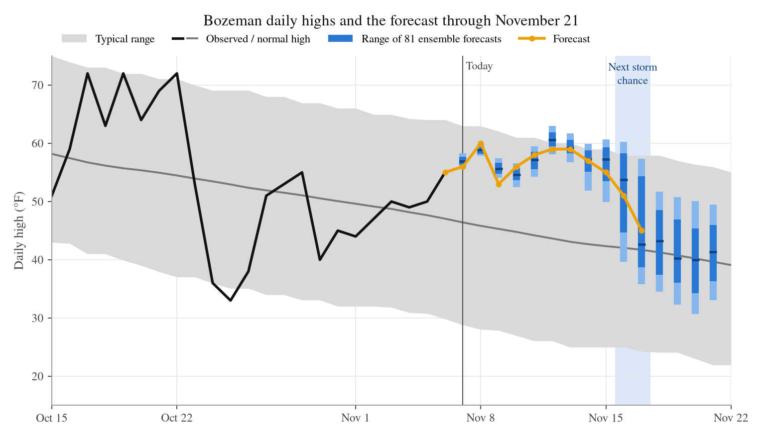 Daily high temperatures and forecast with respect to climatology.
The models are showing a dry cold front next weekend that will help knock temperatures down a bit. The earliest shot at real snow and seasonable cold looks like next Monday night into Tuesday (~10 days from now). The timing has been slipping in the models, which is never a great sign, and there's a real possibility the storm could stall off California. This one is pretty 50/50 at this point, and there's not really much confidence in it until we see a real signal within the 7 day range. If we’re looking for any hopium, the European ensemble does show a bigger storm in about 1-in-3 of its ensemble members.
In the meantime, if things stay quiet this upcoming week, I’ll try to do a more generic post on a topic like “Most favorable storm patterns for Bridger and Big Sky” or “Impacts of Climate Change on our Ski Areas”. I'm open to any other suggestions/ideas. Feel free to drop them in the comments! Thanks for reading!
Comments